
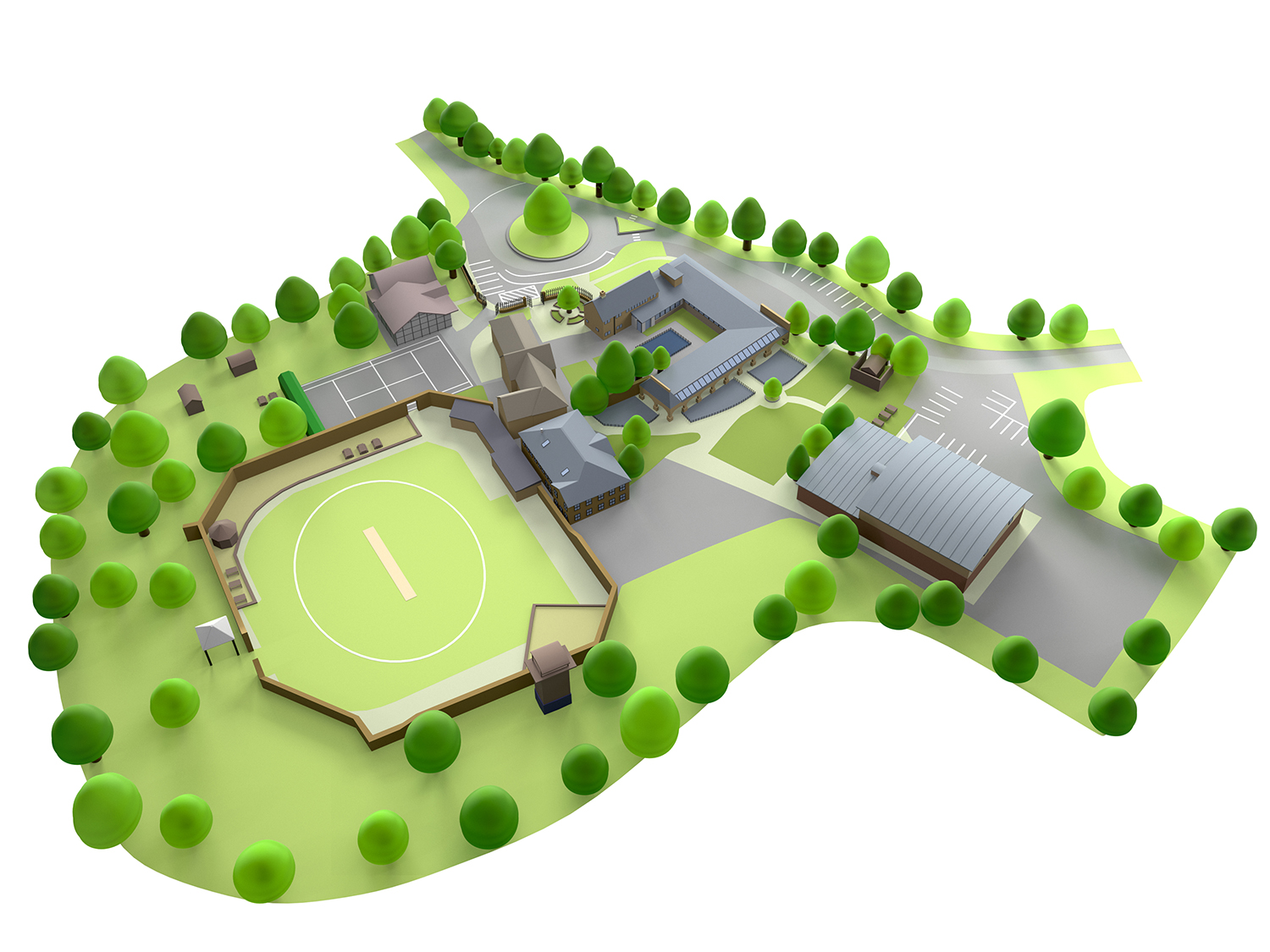
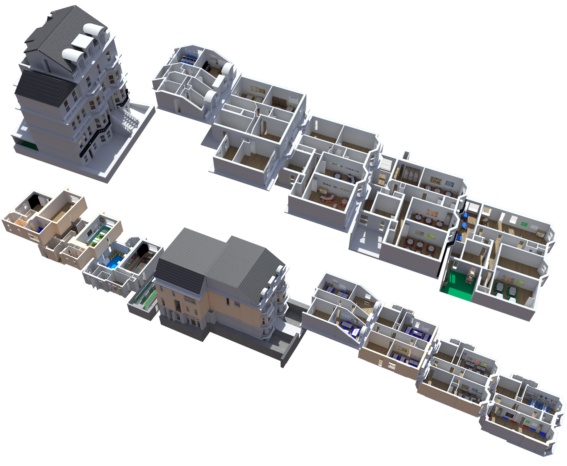
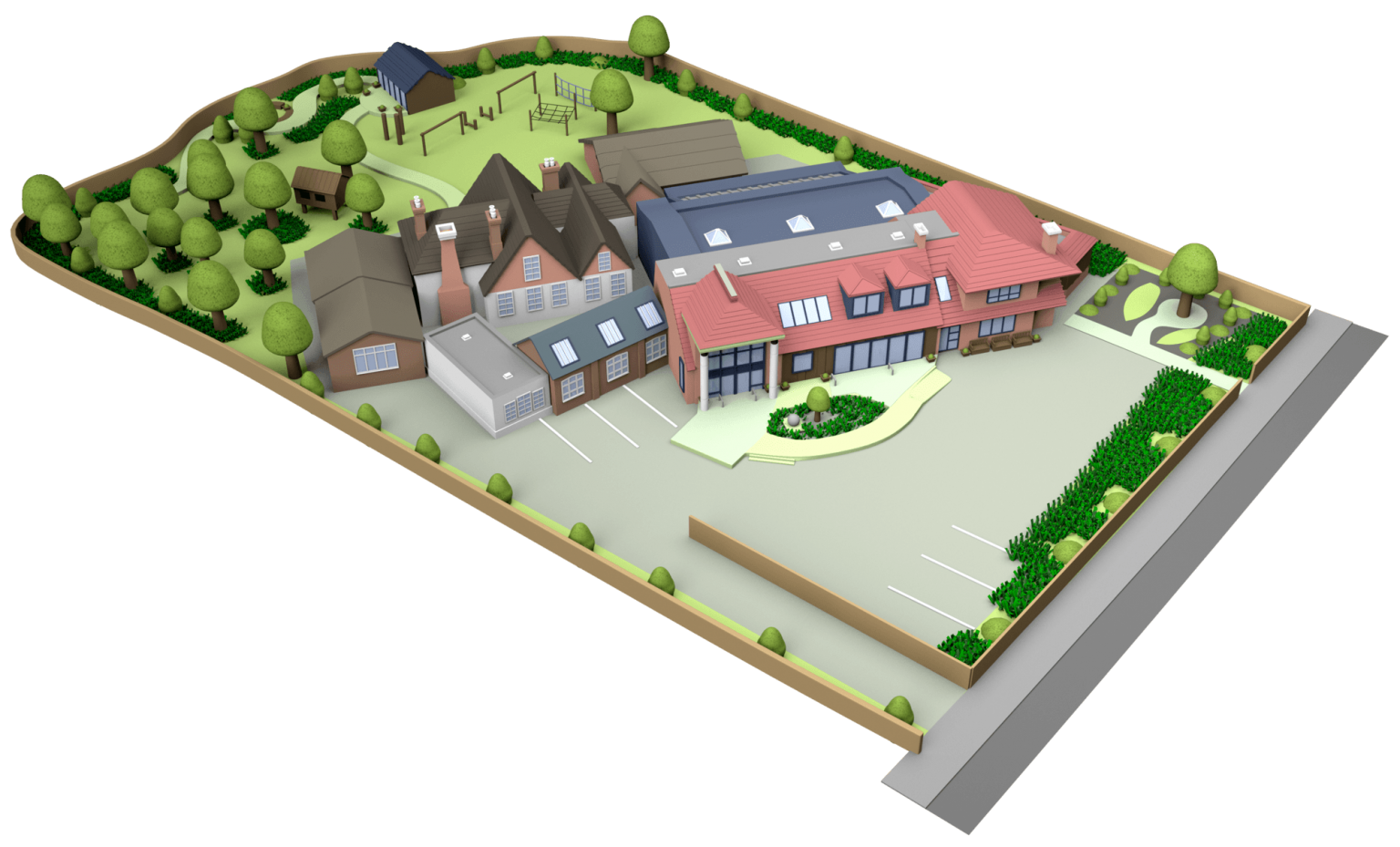
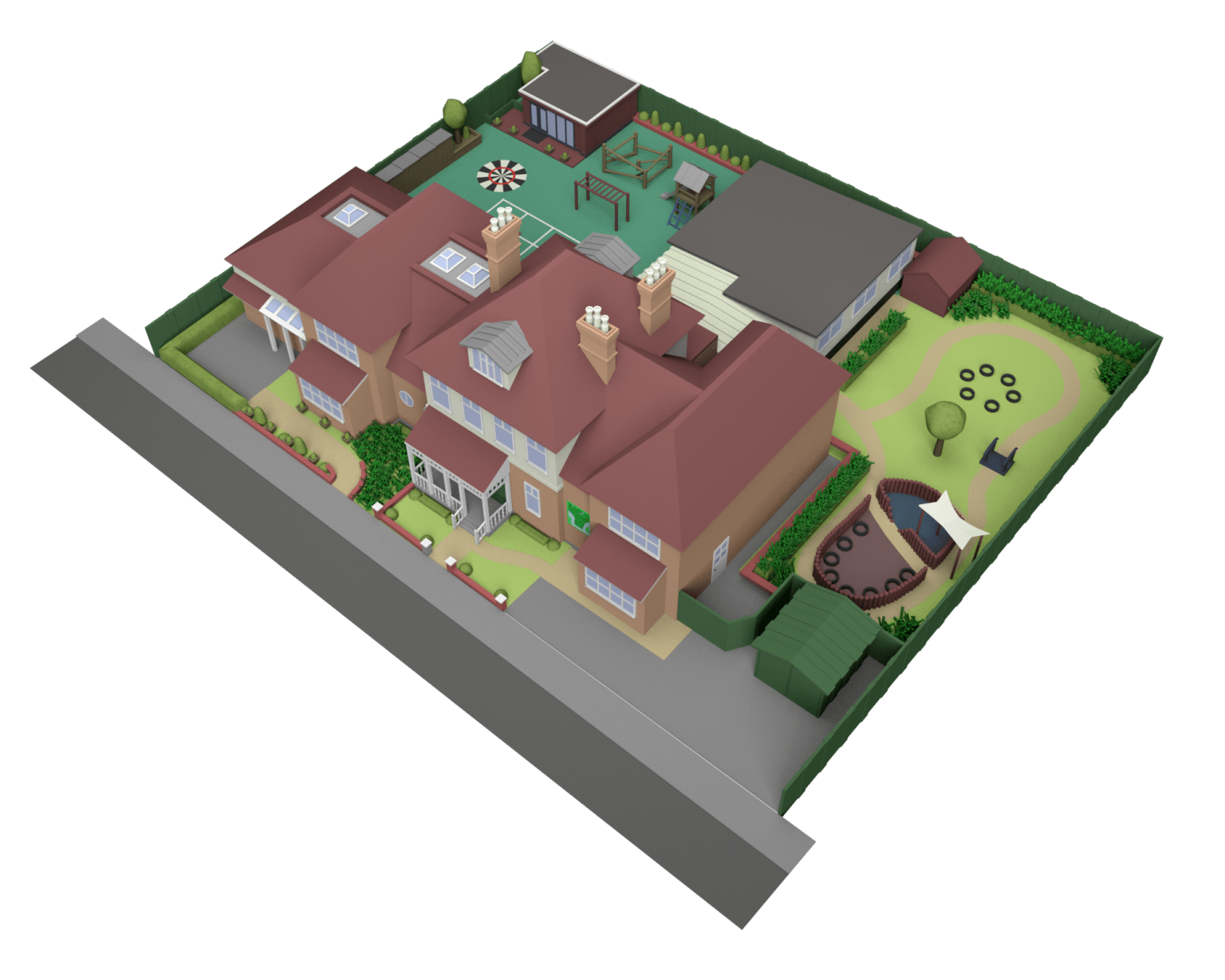
3D School Map Illustrations
LONG LASTING, UPDATEABLE 3D MAPS
If you’re looking for a way to show off your school grounds there is no better way than a 3D illustrated school map. These are cheaper to produce than the older illustrated versions and are also much easier to update in the future as you invest in new buildings.
These can rendered at any size you require and can be used to create online interactive maps for your virtual open day experiences.
Please contact us if you would like more information or to obtain a quotation.
Lets Get Started Contact Us
Related Articles

How to write for your school website that wins more admissions
Most school websites are written for the wrong person. They are written for governors. For inspectors. For the school itself. Not for the parent sitting at the kitchen table at 10pm, quietly weighing up whether your school is right for their child. That parent is intelligent, time-pressed and slightly anxious....

The Comeback Campaign: How Old Vicarage School Rebuilt Its Search Visibility and Came Back Stronger
We began working with Old Vicarage School on an SEO campaign in May 2025. Like many schools navigating a busy academic year, the campaign paused towards the end of the year. But when it resumed, it came back with real momentum and the results have been impressive ever since. This...

Google’s March 2026 Core Update: What It Means for Your SEO Strategy
Google has begun rolling out its March 2026 core update, and as with every major algorithm shift, we are already seeing movement across rankings, visibility and traffic. From a digital strategy perspective, this is not just another update to observe. It is a moment that reveals where Google is heading...