
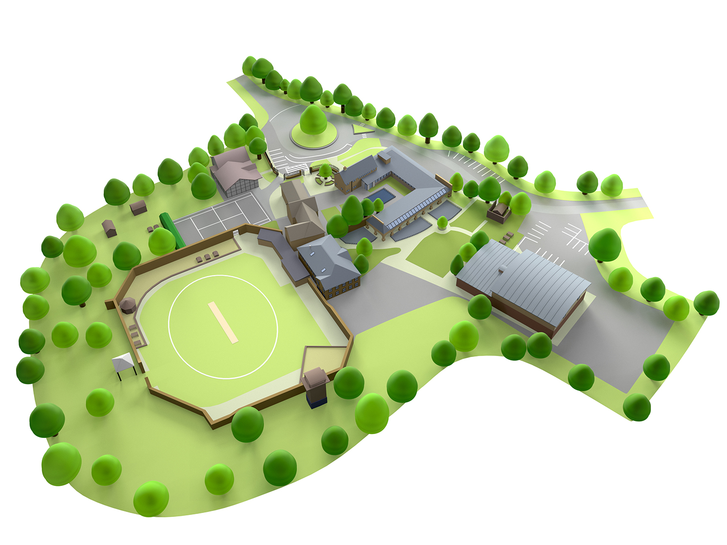
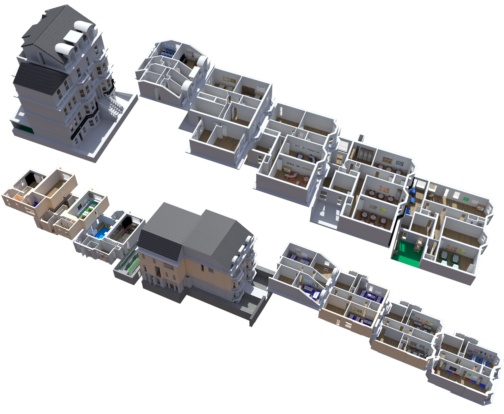
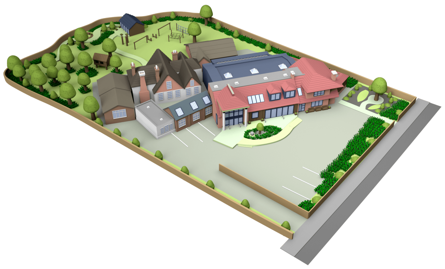
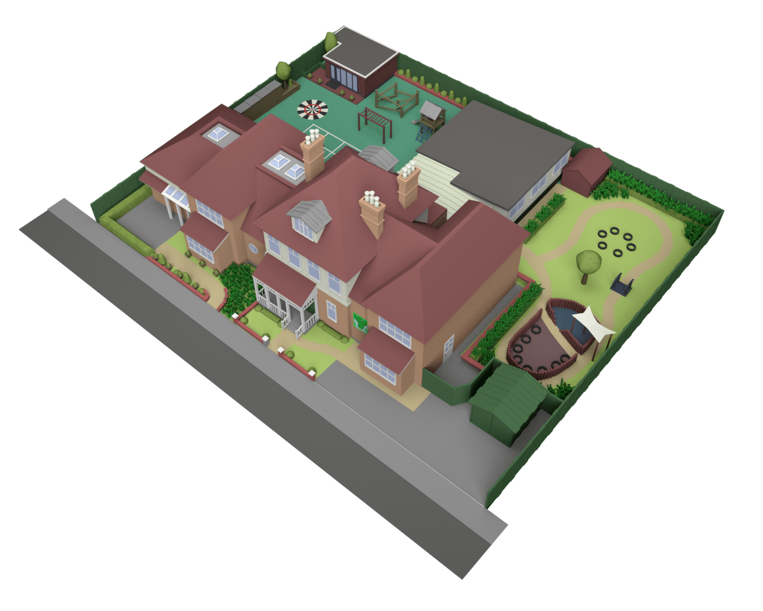
3D School Map Illustrations
LONG LASTING, UPDATEABLE 3D MAPS
If you’re looking for a way to show off your school grounds there is no better way than a 3D illustrated school map. These are cheaper to produce than the older illustrated versions and are also much easier to update in the future as you invest in new buildings.
These can rendered at any size you require and can be used to create online interactive maps for your virtual open day experiences.
Please contact us if you would like more information or to obtain a quotation.
Lets Get Started Contact Us
Related Articles

Why You Need Both SEO and AEO in 2026
Here is a question worth asking yourself: is your brand visible in AI-generated answers? Not just ranking on Google – but actually being cited when someone asks ChatGPT, Gemini, or Claude a question in your space? If you are not sure, or if you have assumed that your SEO work...

Meta’s Andromeda Update: What It Means for Facebook and Instagram Advertising
Meta has introduced a major update to the way ads are delivered across Facebook and Instagram. The new system, called Andromeda, uses artificial intelligence to improve how ads are matched with users. Fully rolled out globally around October 2025, this update is designed to help Meta analyse millions of ads...

How We Helped Collingham College Dominate Page One of Google
When Collingham College came to us, they had a clear goal: to be found by the right people at the right time. Prospective students and parents searching for educational opportunities needed to discover them online — and we made sure that happened. Within just one year of implementing a focused...